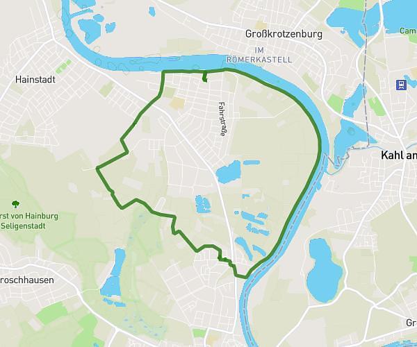
This cycling route covers 5.178mi starting from Seligenstadt, Hesse. The ride does not return to the trailhead and ends near Berliner Straße 97, 63500 Seligenstadt, Germany. This route is rated as easy, plan for about 31m14s to complete it. The route has an elevation gain of 223ft and an elevation loss of 203ft.
Fahrrad Route
Route details
276 kcal
Calories burned
1.6%
Avg grade
Point to point
Route type
348ft
Min altitude
377ft
Max altitude
Route profile
223ft
Elevation gain
203ft
Elevation loss
348ft
Min altitude
377ft
Max altitude
How to get there
Trailhead: Reichenberger Straße 14, 63500 Seligenstadt, Germany
GPS coordinates of the trailhead: 50.05769, 8.96642 / 50°3'27'' N, 8°57'59'' E