MapPlanner
6.155mi
Distance
37m
Duration
9.98mph
Speed
+289ft
Elevation gain
-289ft
Elevation loss
Easy
Level

Fahrrad tour

Route details

328 kcal
Calories burned
1.8%
Avg grade
Loop trail
Route type
328ft
Min altitude
384ft
Max altitude

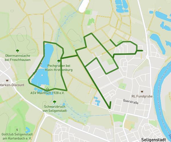
This cycling route covers 6.155mi starting from Seligenstadt, Hesse. The ride is a loop trail and returns to the trailhead. This route is rated as easy, plan for about 37m to complete it. The route has an elevation gain of 289ft and an elevation loss of 289ft.

Route profile

289ft
Elevation gain
289ft
Elevation loss
328ft
Min altitude
384ft
Max altitude

How to get there

Trailhead: Berliner Straße 97, 63500 Seligenstadt, Germany

GPS coordinates of the trailhead: 50.055888, 8.97292 / 50°3'21'' N, 8°58'22'' E

Caution: May Cross Private Property

This route may pass through or near private property. Always respect posted signs, obtain permission where required, and follow local trespassing laws. MapPlanner does not guarantee public access along any route.

Safety Notice

Trail and road conditions may change without notice due to weather, construction, or other factors. Always verify current conditions before heading out. You are responsible for your own safety — follow local signage, obey traffic laws, and use your best judgment on the trail.