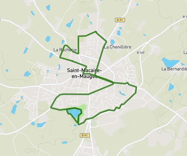
This running route covers 2.509mi starting from Cholet, Maine-et-Loire. The run is a loop trail and returns to the trailhead. This run is rated as easy, expect about 27m to complete it. The route has an elevation gain of 49ft and an elevation loss of 49ft.
4 km
Route details
5.57mph
Speed
309 kcal
Calories burned
Loop trail
Route type
243ft
Min altitude
292ft
Max altitude
Route profile
49ft
Elevation gain
49ft
Elevation loss
243ft
Min altitude
292ft
Max altitude
How to get there
Trailhead: 22 Rue Jean Jaurès, 49300 Cholet, France
GPS coordinates of the trailhead: 47.06314, -0.88494 / 47°3'47'' N, 0°53'5'' W