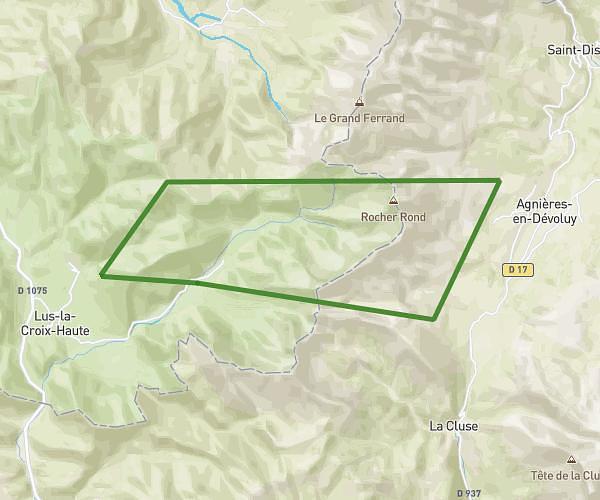
This hiking trail covers 8.397mi starting from Dévoluy, Hautes-Alpes. The hike does not return to the trailhead and ends near 90 Rue De La Chapelle, 26620 Lus-la-Croix-Haute, France. This hike is rated as strenuous, plan for about 6h15m to complete it. The route has an elevation gain of 2398ft and an elevation loss of 3205ft.
Tour du devoluy jour 2
Route details
1.34mph
Speed
2862 kcal
Calories burned
12.6%
Avg grade
Point to point
Route type
3776ft
Min altitude
6585ft
Max altitude
Steep climb
Route profile
2398ft
Elevation gain
3205ft
Elevation loss
3776ft
Min altitude
6585ft
Max altitude
How to get there
Trailhead: 15 Route De Rocher Rond, 05250 Dévoluy, France
GPS coordinates of the trailhead: 44.69199, 5.8637 / 44°41'31'' N, 5°51'49'' E