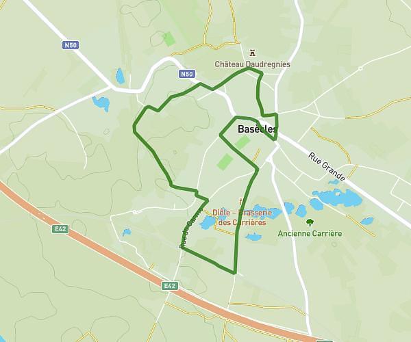
This hiking trail covers 3.785mi starting from Tournai, Hainaut. The hike is a loop trail and returns to the trailhead. This hike is rated as easy, plan for about 1h19m to complete it. The route has an elevation gain of 203ft and an elevation loss of 203ft.
havinnes 6091 metres
Route details
2.88mph
Speed
562 kcal
Calories burned
2.0%
Avg grade
Loop trail
Route type
79ft
Min altitude
184ft
Max altitude
Route profile
203ft
Elevation gain
203ft
Elevation loss
79ft
Min altitude
184ft
Max altitude
How to get there
Trailhead: Rue Du Roi Chevalier 4, 7531 Tournai, Hainaut, Belgium
GPS coordinates of the trailhead: 50.6162, 3.463605 / 50°36'58'' N, 3°27'48'' E