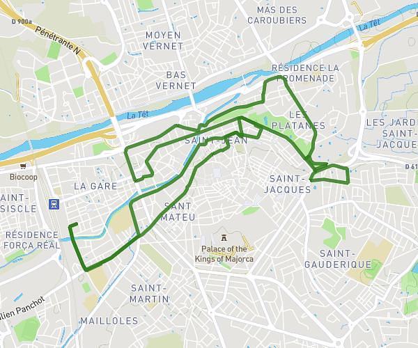
This running route covers 4.776mi starting from Toulouges, Pyrénées-Orientales. The run is a loop trail and returns to the trailhead. This run is rated as easy, expect about 46m to complete it. The route has an elevation gain of 151ft and an elevation loss of 151ft.
Course 4
Route details
6.23mph
Speed
526 kcal
Calories burned
Loop trail
Route type
180ft
Min altitude
279ft
Max altitude
Route profile
151ft
Elevation gain
151ft
Elevation loss
180ft
Min altitude
279ft
Max altitude
How to get there
Trailhead: Rue Des Albères, 66350 Toulouges
GPS coordinates of the trailhead: 42.6652, 2.83332 / 42°39'54'' N, 2°49'59'' E