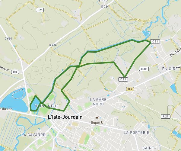
This running route covers 3.247mi starting from Merville, Haute-Garonne. The run is a loop trail and returns to the trailhead. This run is rated as easy, expect about 34m50s to complete it. The route has an elevation gain of 180ft and an elevation loss of 180ft.
5km de Merville
Route details
5.59mph
Speed
398 kcal
Calories burned
Loop trail
Route type
466ft
Min altitude
531ft
Max altitude
Route profile
180ft
Elevation gain
180ft
Elevation loss
466ft
Min altitude
531ft
Max altitude
How to get there
Trailhead: 50 Promenade De La Tuilerie, 31330 Merville, France
GPS coordinates of the trailhead: 43.715093, 1.303988 / 43°42'54'' N, 1°18'14'' E