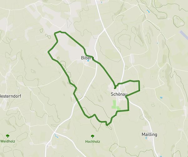
This running route covers 6.204mi starting from Glonn, Bavaria. The run is a loop trail and returns to the trailhead. This run is rated as moderate, expect about 1h7m to complete it. The route has an elevation gain of 509ft and an elevation loss of 509ft.
10km Glonn
Route details
5.56mph
Speed
766 kcal
Calories burned
Loop trail
Route type
1752ft
Min altitude
2044ft
Max altitude
Route profile
509ft
Elevation gain
509ft
Elevation loss
1752ft
Min altitude
2044ft
Max altitude
How to get there
Trailhead: Wolfgang-Wagner-Straße 13, 85625 Glonn, Germany
GPS coordinates of the trailhead: 47.987597, 11.867362 / 47°59'15'' N, 11°52'2'' E