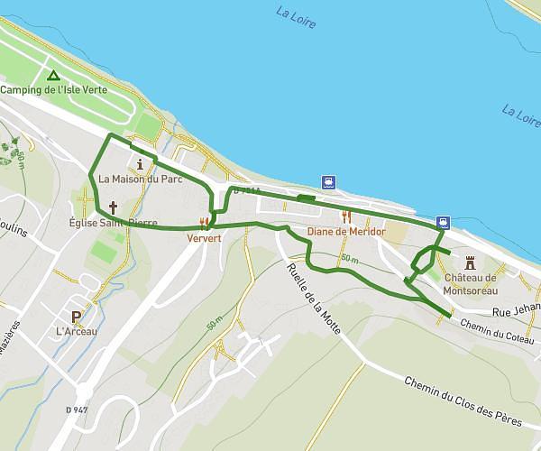
This walking route covers 1.386mi starting from Saumur, Maine-et-Loire. The walk is a loop trail and returns to the trailhead. This walk is rated as easy, plan for about 30m to complete it. The route has an elevation gain of 161ft and an elevation loss of 161ft.
Langlois Chateau
Route details
21:39/mi
Pace
123 kcal
Calories burned
Loop trail
Route type
125ft
Min altitude
233ft
Max altitude
Route profile
161ft
Elevation gain
161ft
Elevation loss
125ft
Min altitude
233ft
Max altitude
How to get there
Trailhead: Allée Marie-Agnès Besgnard, 49400 Saumur
GPS coordinates of the trailhead: 47.26445, -0.1048 / 47°15'52'' N, 0°6'17'' W