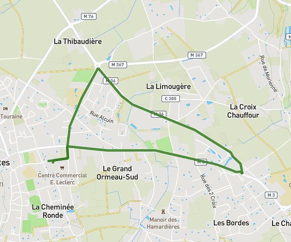
This walking route covers 1.924mi starting from Coteaux-sur-Loire, Indre-et-Loire. The walk does not return to the trailhead and ends near 2 Allée Des Chênaies, 37130 Coteaux-sur-Loire, France. This walk is rated as easy, plan for about 46m27s to complete it. The route has an elevation gain of 305ft and an elevation loss of 197ft.
Balade jusqu'au Mont Sigou
Route details
24:08/mi
Pace
190 kcal
Calories burned
Point to point
Route type
115ft
Min altitude
387ft
Max altitude
Route profile
305ft
Elevation gain
197ft
Elevation loss
115ft
Min altitude
387ft
Max altitude
How to get there
Trailhead: 36 Rue De Touraine, 37130 Coteaux-sur-Loire, France
GPS coordinates of the trailhead: 47.28156, 0.27254 / 47°16'53'' N, 0°16'21'' E