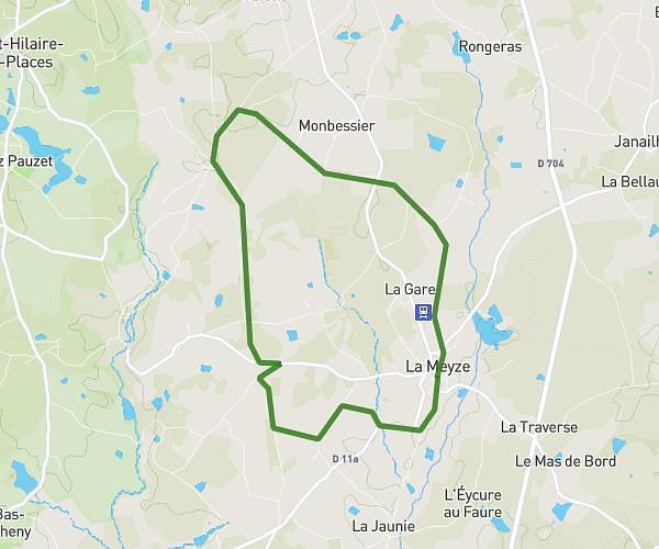
This running route covers 2.618mi starting from Saint-Germain-les-Belles, Haute-Vienne. The run is a loop trail and returns to the trailhead. This run is rated as easy, expect about 25m to complete it. The route has an elevation gain of 131ft and an elevation loss of 121ft.
Mon parcours classique
Route details
6.28mph
Speed
286 kcal
Calories burned
Loop trail
Route type
1355ft
Min altitude
1486ft
Max altitude
Route profile
131ft
Elevation gain
121ft
Elevation loss
1355ft
Min altitude
1486ft
Max altitude
How to get there
Trailhead: Impasse De La Bagatelle, 87380 Saint-Germain-les-Belles, France
GPS coordinates of the trailhead: 45.62221, 1.49929 / 45°37'19'' N, 1°29'57'' E