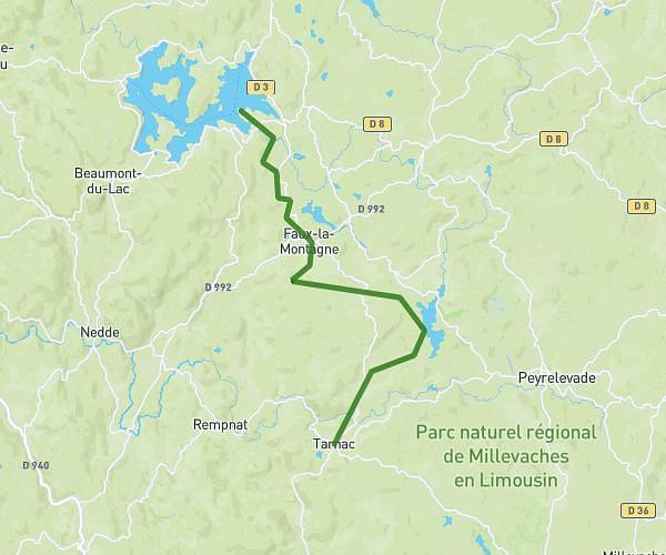
This running route covers 9.587mi starting from Nedde, Haute-Vienne. The run does not return to the trailhead and ends near 13 Avenue De La Mairie, 19170 Tarnac, France. This run is rated as easy, expect about 1h42m to complete it. The route has an elevation gain of 2211ft and an elevation loss of 1568ft.
Etape Nedde Tarnac
Route details
5.59mph
Speed
1176 kcal
Calories burned
Point to point
Route type
1657ft
Min altitude
2405ft
Max altitude
Route profile
2211ft
Elevation gain
1568ft
Elevation loss
1657ft
Min altitude
2405ft
Max altitude
How to get there
Trailhead: 18 Route De Plainartige, 87120 Nedde, France
GPS coordinates of the trailhead: 45.71926, 1.83113 / 45°43'9'' N, 1°49'52'' E