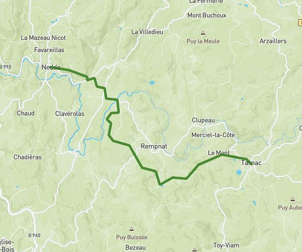
This running route covers 14.444mi starting from Tarnac, Corrèze. The run does not return to the trailhead and ends near 680 Route De Broussas, 23460 Royère-de-Vassivière, France. This run is rated as strenuous, expect about 2h34m to complete it. The route has an elevation gain of 1732ft and an elevation loss of 1900ft.
Tarnac Broussas
Route details
5.59mph
Speed
1772 kcal
Calories burned
Point to point
Route type
2096ft
Min altitude
2559ft
Max altitude
Route profile
1732ft
Elevation gain
1900ft
Elevation loss
2096ft
Min altitude
2559ft
Max altitude
How to get there
Trailhead: 18 Avenue De La Mairie, 19170 Tarnac, France
GPS coordinates of the trailhead: 45.681118, 1.946218 / 45°40'52'' N, 1°56'46'' E