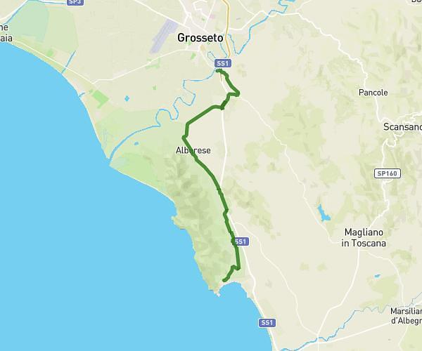
This running route covers 3.644mi starting from Grosseto, Grosseto. The run is a loop trail and returns to the trailhead. This run is rated as easy, expect about 35m to complete it. The route has an elevation gain of 92ft and an elevation loss of 92ft.
Casa corto
Route details
6.24mph
Speed
400 kcal
Calories burned
Loop trail
Route type
26ft
Min altitude
46ft
Max altitude
Route profile
92ft
Elevation gain
92ft
Elevation loss
26ft
Min altitude
46ft
Max altitude
How to get there
Trailhead: Via Canada 20, 58100 Grosseto Grosseto, Italy
GPS coordinates of the trailhead: 42.77708, 11.11487 / 42°46'37'' N, 11°6'53'' E