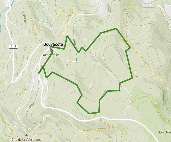
This hiking trail covers 3.887mi starting from Saint-Nabord, Vosges. The hike is a loop trail and returns to the trailhead. This hike is rated as moderate, plan for about 1h30m to complete it. The route has an elevation gain of 653ft and an elevation loss of 666ft.
borlier definitif
Route details
2.59mph
Speed
663 kcal
Calories burned
6.4%
Avg grade
Loop trail
Route type
1657ft
Min altitude
1877ft
Max altitude
Route profile
653ft
Elevation gain
666ft
Elevation loss
1657ft
Min altitude
1877ft
Max altitude
How to get there
Trailhead: 1 Bellerouveroye, 88200 Saint-Nabord, France
GPS coordinates of the trailhead: 48.043271, 6.569017 / 48°2'35'' N, 6°34'8'' E