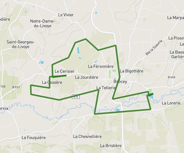
This running route covers 3.912mi starting from Chanteloup, Manche. The run is a loop trail and returns to the trailhead. This run is rated as easy, expect about 2h1m to complete it. The route has an elevation gain of 174ft and an elevation loss of 174ft.
maison
Route details
1.94mph
Speed
1383 kcal
Calories burned
Loop trail
Route type
138ft
Min altitude
226ft
Max altitude
Route profile
174ft
Elevation gain
174ft
Elevation loss
138ft
Min altitude
226ft
Max altitude
How to get there
Trailhead: 327 Route D'orion, 50510 Chanteloup, France
GPS coordinates of the trailhead: 48.89692, -1.46219 / 48°53'48'' N, 1°27'43'' W