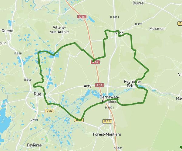
This cycling route covers 20.211mi starting from Rue, Somme. The ride does not return to the trailhead and ends near 3 Rue Du Marais, 80120 Rue, France. This route is rated as moderate, plan for about 2h2m to complete it. The route has an elevation gain of 148ft and an elevation loss of 285ft.
Ruenne 2026 32 VTT Orange
Route details
1069 kcal
Calories burned
0.4%
Avg grade
Point to point
Route type
13ft
Min altitude
151ft
Max altitude
Route profile
148ft
Elevation gain
285ft
Elevation loss
13ft
Min altitude
151ft
Max altitude
How to get there
Trailhead: 6 Place Du Général De Gaulle, 80120 Rue, France
GPS coordinates of the trailhead: 50.271088, 1.674827 / 50°16'15'' N, 1°40'29'' E