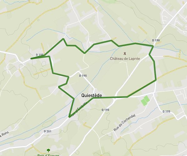
This hiking trail covers 4.639mi starting from Blendecques, Pas-de-Calais. The hike is a loop trail and returns to the trailhead. This hike is rated as easy, plan for about 24m to complete it. The route has an elevation gain of 371ft and an elevation loss of 367ft.
Blendecques
Route details
11.59mph
Speed
172 kcal
Calories burned
3.0%
Avg grade
Loop trail
Route type
52ft
Min altitude
272ft
Max altitude
Route profile
371ft
Elevation gain
367ft
Elevation loss
52ft
Min altitude
272ft
Max altitude
How to get there
Trailhead: 145 Rue Jean Jaurès, 62575 Blendecques, France
GPS coordinates of the trailhead: 50.715138, 2.272815 / 50°42'54'' N, 2°16'22'' E