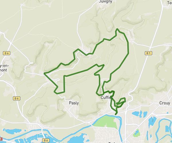
This running route covers 7.829mi starting from Vieux-Moulin, Oise. The run is a loop trail and returns to the trailhead. This run is rated as hard, expect about 1h16m to complete it. The route has an elevation gain of 262ft and an elevation loss of 233ft.
Vieux moulin
Route details
6.18mph
Speed
869 kcal
Calories burned
Loop trail
Route type
148ft
Min altitude
410ft
Max altitude
Route profile
262ft
Elevation gain
233ft
Elevation loss
148ft
Min altitude
410ft
Max altitude
How to get there
Trailhead: D 602, 60350 Vieux-Moulin
GPS coordinates of the trailhead: 49.39019, 2.93153 / 49°23'24'' N, 2°55'53'' E