MapPlanner
5.293mi
Distance
1h3m
Duration
12:04/mi
Pace
Moderate
Level

test

Route details

4.97mph
Speed
730 kcal
Calories burned
Loop trail
Route type
266ft
Min altitude
971ft
Max altitude

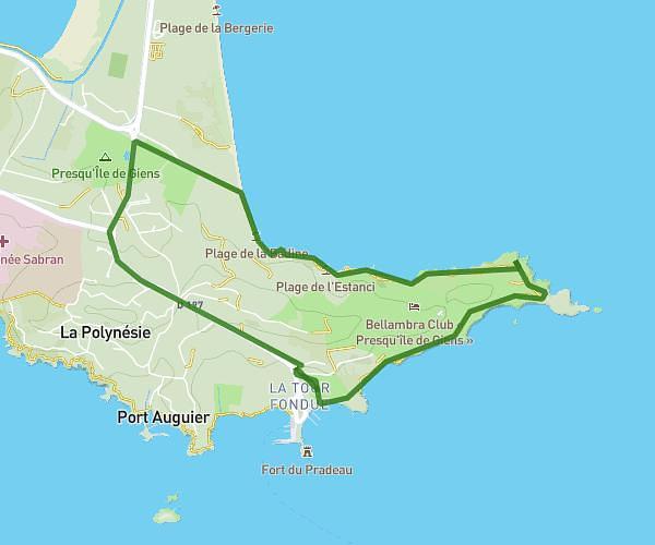
This running route covers 5.293mi starting from Solliès-Pont, Var. The run is a loop trail and returns to the trailhead. This run is rated as moderate, expect about 1h3m to complete it. The route has an elevation gain of 909ft and an elevation loss of 896ft.

Route profile

909ft
Elevation gain
896ft
Elevation loss
266ft
Min altitude
971ft
Max altitude

How to get there

Trailhead: Avenue Du Lion, 83210 Solliès-Pont

GPS coordinates of the trailhead: 43.20053, 6.05054 / 43°12'1'' N, 6°3'1'' E

Caution: May Cross Private Property

This route may pass through or near private property. Always respect posted signs, obtain permission where required, and follow local trespassing laws. MapPlanner does not guarantee public access along any route.

Safety Notice

Trail and road conditions may change without notice due to weather, construction, or other factors. Always verify current conditions before heading out. You are responsible for your own safety — follow local signage, obey traffic laws, and use your best judgment on the trail.