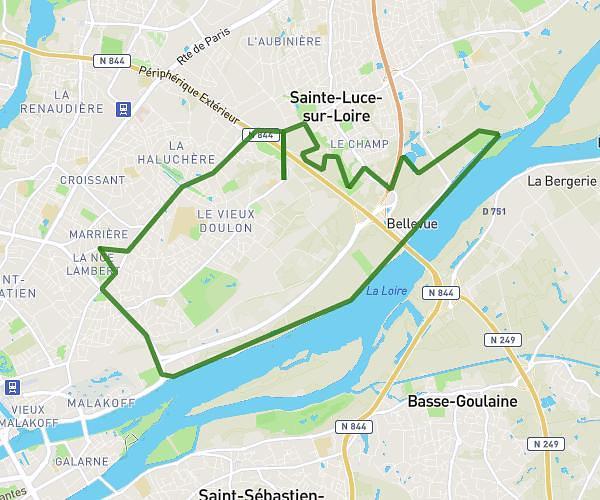
This running route covers 3.41mi starting from Ancenis-Saint-Géréon, Loire-Atlantique. The run is a loop trail and returns to the trailhead. This run is rated as easy, expect about 29m to complete it. The route has an elevation gain of 23ft and an elevation loss of 33ft.
Pierre 5km
Route details
7.05mph
Speed
332 kcal
Calories burned
Loop trail
Route type
46ft
Min altitude
75ft
Max altitude
Route profile
23ft
Elevation gain
33ft
Elevation loss
46ft
Min altitude
75ft
Max altitude
How to get there
Trailhead: 720 Rue De La Gilarderie, 44150 Ancenis-Saint-Géréon, France
GPS coordinates of the trailhead: 47.380103, -1.193093 / 47°22'48'' N, 1°11'35'' W