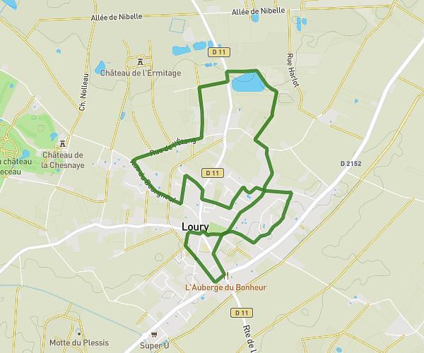
This hiking trail covers 4.738mi starting from Loury, Loiret. The hike is a loop trail and returns to the trailhead. This hike is rated as easy, plan for about 1h41m to complete it. The route has an elevation gain of 289ft and an elevation loss of 289ft.
Randonnée du 14 février
Route details
2.79mph
Speed
727 kcal
Calories burned
2.3%
Avg grade
Loop trail
Route type
387ft
Min altitude
482ft
Max altitude
Route profile
289ft
Elevation gain
289ft
Elevation loss
387ft
Min altitude
482ft
Max altitude
How to get there
Trailhead: 13 Rue Henri De Toulouse-Lautrec, 45470 Loury, France
GPS coordinates of the trailhead: 48.00165, 2.08524 / 48°0'5'' N, 2°5'6'' E