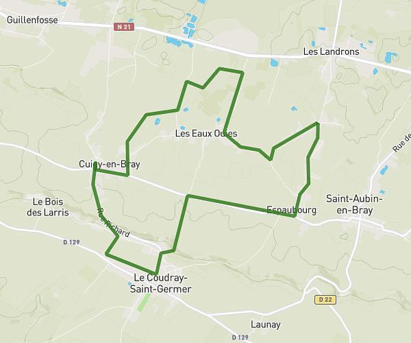
This running route covers 18.296mi starting from Hécourt, Oise. The run is a loop trail and returns to the trailhead. This run is rated as strenuous, expect about 3h16m to complete it. The route has an elevation gain of 151ft and an elevation loss of 184ft.
RANDONNÉE DU 18/19 OCTOBRE DIMANCHE
Route details
5.6mph
Speed
2241 kcal
Calories burned
Loop trail
Route type
459ft
Min altitude
597ft
Max altitude
Route profile
151ft
Elevation gain
184ft
Elevation loss
459ft
Min altitude
597ft
Max altitude
How to get there
Trailhead: 50 Impasse De La Ruellette, 60380 Hécourt, France
GPS coordinates of the trailhead: 49.52058, 1.76024 / 49°31'14'' N, 1°45'36'' E