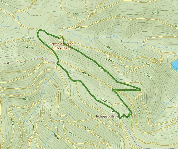
This hiking trail covers 11.931mi starting from Rouffach, Haut-Rhin. The hike is a loop trail and returns to the trailhead. This hike is rated as strenuous, plan for about 1h11m to complete it. The route has an elevation gain of 2352ft and an elevation loss of 2349ft.
Boenlesgrab etc...
Route details
10.08mph
Speed
528 kcal
Calories burned
7.5%
Avg grade
Loop trail
Route type
2674ft
Min altitude
3757ft
Max altitude
Route profile
2352ft
Elevation gain
2349ft
Elevation loss
2674ft
Min altitude
3757ft
Max altitude
How to get there
Trailhead: Chemin Forestier Du Boenlesgrab, 68230 Rouffach
GPS coordinates of the trailhead: 47.97647, 7.148 / 47°58'35'' N, 7°8'52'' E