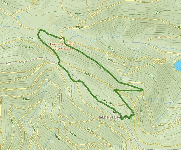
This hiking trail covers 5.34mi starting from Rimbach-près-Masevaux, Haut-Rhin. The hike is a loop trail and returns to the trailhead. This hike is rated as hard, plan for about 40m to complete it. The route has an elevation gain of 1522ft and an elevation loss of 1519ft.
Petite boucle Ermensbach
Route details
8.01mph
Speed
305 kcal
Calories burned
10.8%
Avg grade
Loop trail
Route type
1752ft
Min altitude
3133ft
Max altitude
Steep climb
Route profile
1522ft
Elevation gain
1519ft
Elevation loss
1752ft
Min altitude
3133ft
Max altitude
How to get there
Trailhead: Rue D'ermensbach, 68290 Rimbach-près-Masevaux
GPS coordinates of the trailhead: 47.81822, 6.94009 / 47°49'5'' N, 6°56'24'' E