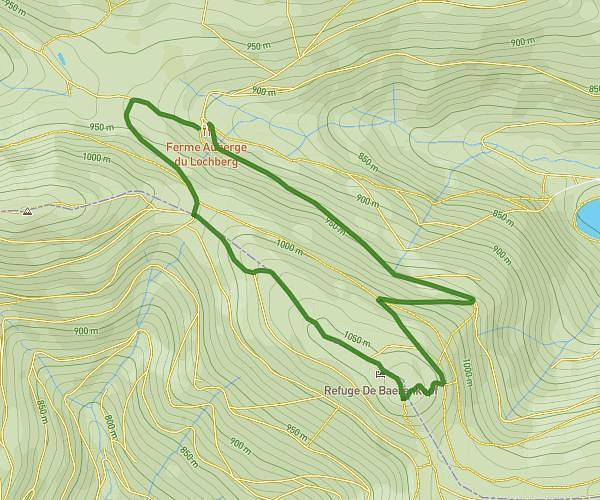
This hiking trail covers 9.246mi starting from Lautenbach, Haut-Rhin. The hike is a loop trail and returns to the trailhead. This hike is rated as strenuous, plan for about 1h12m to complete it. The route has an elevation gain of 1962ft and an elevation loss of 1949ft.
Rcrcrc
Route details
7.71mph
Speed
538 kcal
Calories burned
8.0%
Avg grade
Loop trail
Route type
2654ft
Min altitude
3763ft
Max altitude
Steep climb
Route profile
1962ft
Elevation gain
1949ft
Elevation loss
2654ft
Min altitude
3763ft
Max altitude
How to get there
Trailhead: Chemin Du Ruhfelsen, 68610 Lautenbach
GPS coordinates of the trailhead: 47.9763, 7.14768 / 47°58'34'' N, 7°8'51'' E