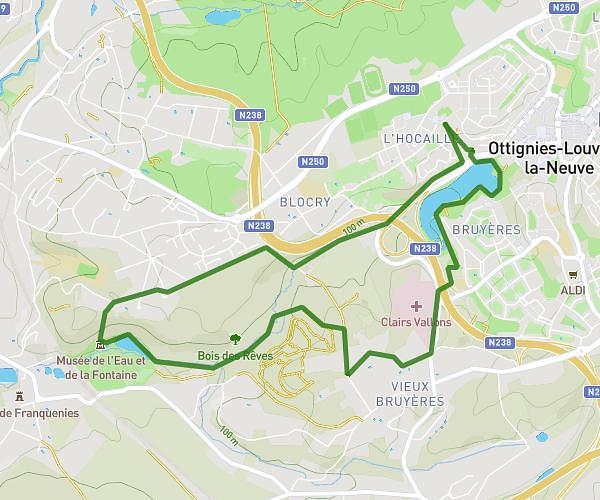
This running route covers 9.452mi starting from Brussels, Brussels-Capital. The run is a loop trail and returns to the trailhead. This run is rated as hard, expect about 1h20m to complete it. The route has an elevation gain of 663ft and an elevation loss of 669ft.
Ixelles 15km
Route details
7.09mph
Speed
915 kcal
Calories burned
Loop trail
Route type
305ft
Min altitude
469ft
Max altitude
Route profile
663ft
Elevation gain
669ft
Elevation loss
305ft
Min altitude
469ft
Max altitude
How to get there
Trailhead: Avenue Paul Héger - Paul Hégerlaan 28, 1000 Brussels, Brussels-Capital, Belgium
GPS coordinates of the trailhead: 50.81359, 4.38334 / 50°48'48'' N, 4°23'0'' E