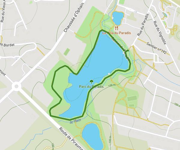
This running route covers 3.34mi starting from Ixelles, Brussels-Capital. The run is a loop trail and returns to the trailhead. This run is rated as easy, expect about 24m49s to complete it. The route has an elevation gain of 157ft and an elevation loss of 154ft.
Ixelles 5km
Route details
8.08mph
Speed
284 kcal
Calories burned
Loop trail
Route type
279ft
Min altitude
364ft
Max altitude
Route profile
157ft
Elevation gain
154ft
Elevation loss
279ft
Min altitude
364ft
Max altitude
How to get there
Trailhead: Avenue Des Grenadiers - Grenadierslaan 56, 1050 Ixelles, Brussels-Capital, Belgium
GPS coordinates of the trailhead: 50.809, 4.39124 / 50°48'32'' N, 4°23'28'' E