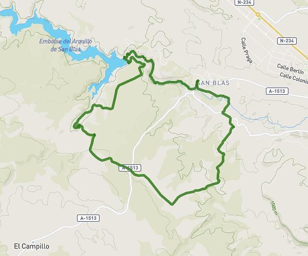
This running route covers 12.624mi starting from Teruel, Teruel. The run is a loop trail and returns to the trailhead. This run is rated as strenuous, expect about 2h15m to complete it. The route has an elevation gain of 367ft and an elevation loss of 469ft.
20k san Blas (senda marines)
Route details
5.59mph
Speed
1548 kcal
Calories burned
Loop trail
Route type
2910ft
Min altitude
3379ft
Max altitude
Route profile
367ft
Elevation gain
469ft
Elevation loss
2910ft
Min altitude
3379ft
Max altitude
How to get there
Trailhead: Calle Del Molino, 44195 Teruel
GPS coordinates of the trailhead: 40.35885, -1.1819 / 40°21'31'' N, 1°10'54'' W