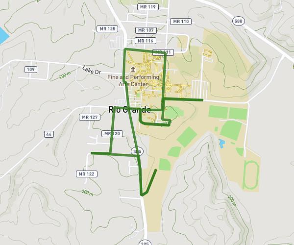
This walking route covers 1.844mi starting from Rio Grande, Ohio. The walk is a loop trail and returns to the trailhead. This walk is rated as easy, plan for about 27m39s to complete it. The route has an elevation gain of 154ft and an elevation loss of 154ft.
Normal walk
Route details
15:00/mi
Pace
113 kcal
Calories burned
Loop trail
Route type
594ft
Min altitude
656ft
Max altitude
Route profile
154ft
Elevation gain
154ft
Elevation loss
594ft
Min altitude
656ft
Max altitude
How to get there
Trailhead: 414 East College Street, Rio Grande, Ohio 45674, United States
GPS coordinates of the trailhead: 38.87991, -82.37838 / 38°52'47'' N, 82°22'42'' W