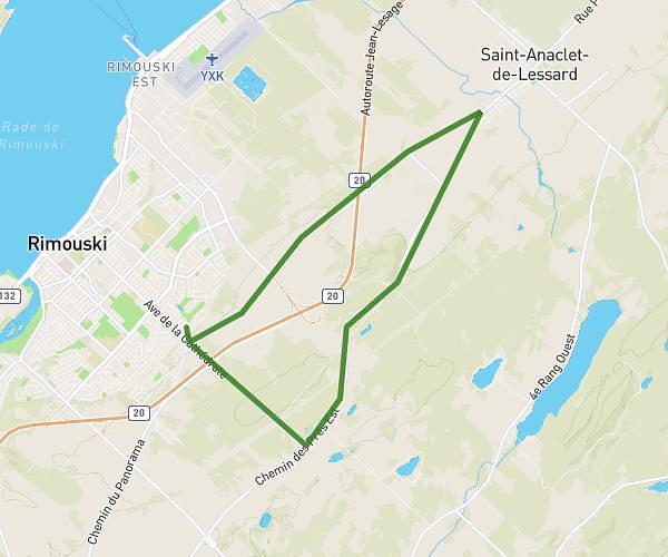
This walking route covers 8.439mi starting from Rimouski, Quebec. The walk does not return to the trailhead and ends near 331 Avenue Rouleau, Rimouski, Quebec G5L 8G8, Canada. This walk is rated as strenuous, plan for about 3h26m to complete it. The route has an elevation gain of 689ft and an elevation loss of 837ft.
Fff
Route details
24:23/mi
Pace
841 kcal
Calories burned
Point to point
Route type
13ft
Min altitude
528ft
Max altitude
Route profile
689ft
Elevation gain
837ft
Elevation loss
13ft
Min altitude
528ft
Max altitude
How to get there
Trailhead: 40 Rue Des Flandres, Rimouski, Quebec G5L 2L5, Canada
GPS coordinates of the trailhead: 48.43763, -68.503 / 48°26'15'' N, 68°30'10'' W