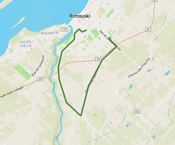
This walking route covers 9.879mi starting from Rimouski, Quebec. The walk does not return to the trailhead and ends near 555 Avenue De La Cathédrale, Rimouski, Quebec G5N 1N9, Canada. This walk is rated as strenuous, plan for about 3h32m to complete it. The route has an elevation gain of 804ft and an elevation loss of 682ft.
NnnBb
Route details
21:27/mi
Pace
866 kcal
Calories burned
Point to point
Route type
164ft
Min altitude
692ft
Max altitude
Route profile
804ft
Elevation gain
682ft
Elevation loss
164ft
Min altitude
692ft
Max altitude
How to get there
Trailhead: 31 Rue Des Flandres, Rimouski, Quebec G5L 2L6, Canada
GPS coordinates of the trailhead: 48.43759, -68.503 / 48°26'15'' N, 68°30'10'' W