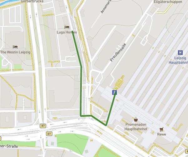
This walking route covers 0.289mi starting from Leipzig, Saxony. The walk does not return to the trailhead and ends near Kurt-Schumacher-Straße 29, 04105 Leipzig, Germany. This walk is rated as easy, plan for about 6m to complete it. The route has an elevation gain of 13ft and an elevation loss of 59ft.
BML
Route details
20:46/mi
Pace
25 kcal
Calories burned
Point to point
Route type
358ft
Min altitude
407ft
Max altitude
Route profile
13ft
Elevation gain
59ft
Elevation loss
358ft
Min altitude
407ft
Max altitude
How to get there
Trailhead: Willy-Brandt-Platz 2c, 04109 Leipzig, Germany
GPS coordinates of the trailhead: 51.345427, 12.380169 / 51°20'43'' N, 12°22'48'' E