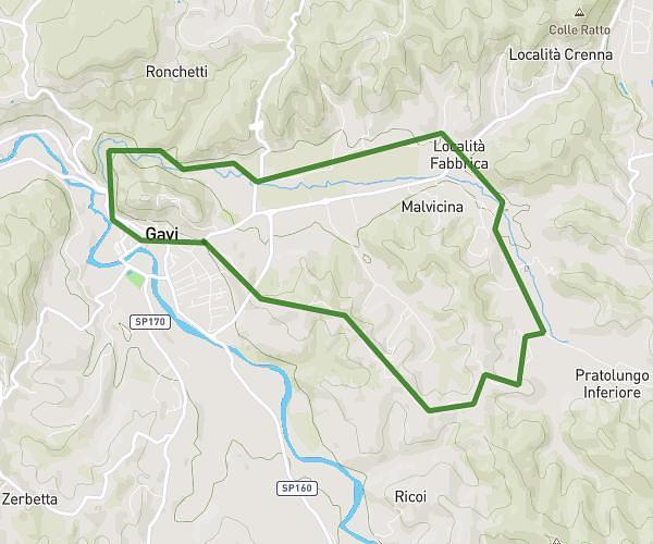
This hiking trail covers 4.379mi starting from Stazzano, Alessandria. The hike does not return to the trailhead and ends near Frazione Monterotondo Zerbe Superiori, 15066 Gavi. This hike is rated as moderate, plan for about 1h36m to complete it. The route has an elevation gain of 705ft and an elevation loss of 367ft.
Da Stazzano a Monterotondo
Route details
2.73mph
Speed
706 kcal
Calories burned
4.6%
Avg grade
Point to point
Route type
669ft
Min altitude
1076ft
Max altitude
Route profile
705ft
Elevation gain
367ft
Elevation loss
669ft
Min altitude
1076ft
Max altitude
How to get there
Trailhead: Strada Vicinale Di Piovera, 15060 Stazzano
GPS coordinates of the trailhead: 44.7293, 8.86307 / 44°43'45'' N, 8°51'47'' E