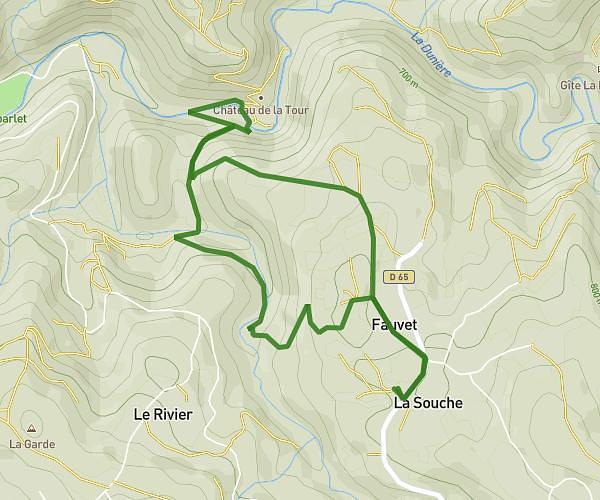
This walking route covers 3.756mi starting from Saint-Didier-en-Velay, Haute-Loire. The walk does not return to the trailhead and ends near Rue Régis Ploton, 43140 Saint-Didier-en-Velay, France. This walk is rated as moderate, plan for about 2h54s to complete it. The route has an elevation gain of 390ft and an elevation loss of 486ft.
6 km
Route details
32:11/mi
Pace
494 kcal
Calories burned
Point to point
Route type
2608ft
Min altitude
2982ft
Max altitude
Route profile
390ft
Elevation gain
486ft
Elevation loss
2608ft
Min altitude
2982ft
Max altitude
How to get there
Trailhead: 14 Rue De La République, 43140 Saint-Didier-en-Velay, France
GPS coordinates of the trailhead: 45.30303, 4.27629 / 45°18'10'' N, 4°16'34'' E