MapPlanner
12.534mi
Distance
1h40m
Duration
7.52mph
Speed
+449ft
Elevation gain
-463ft
Elevation loss
Moderate
Level

Entraînement 20km Bx

Route details

883 kcal
Calories burned
1.4%
Avg grade
Loop trail
Route type
633ft
Min altitude
1076ft
Max altitude

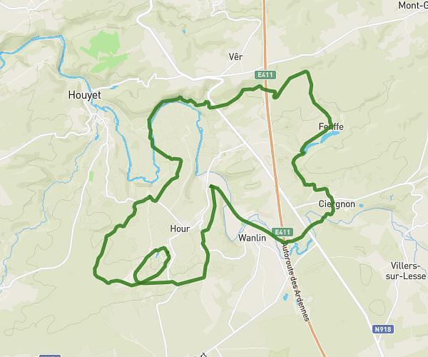
This cycling route covers 12.534mi starting from Ciney, Namur. The ride is a loop trail and returns to the trailhead. This route is rated as moderate, plan for about 1h40m to complete it. The route has an elevation gain of 449ft and an elevation loss of 463ft.

Route profile

449ft
Elevation gain
463ft
Elevation loss
633ft
Min altitude
1076ft
Max altitude

How to get there

Trailhead: Rue De Barvaux, 5590 Ciney

GPS coordinates of the trailhead: 50.2492, 5.19587 / 50°14'57'' N, 5°11'45'' E

Caution: May Cross Private Property

This route may pass through or near private property. Always respect posted signs, obtain permission where required, and follow local trespassing laws. MapPlanner does not guarantee public access along any route.

Safety Notice

Trail and road conditions may change without notice due to weather, construction, or other factors. Always verify current conditions before heading out. You are responsible for your own safety — follow local signage, obey traffic laws, and use your best judgment on the trail.