MapPlanner
2.818mi
Distance
1h30m
Duration
31:58/mi
Pace
Easy
Level

5 walk

Route details

31:58/mi
Pace
368 kcal
Calories burned
Loop trail
Route type
33ft
Min altitude
89ft
Max altitude

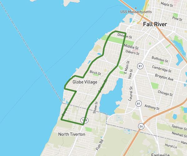
This walking route covers 2.818mi starting from Providence, Rhode Island. The walk is a loop trail and returns to the trailhead. This walk is rated as easy, plan for about 1h30m to complete it. The route has an elevation gain of 92ft and an elevation loss of 92ft.

Route profile

92ft
Elevation gain
92ft
Elevation loss
33ft
Min altitude
89ft
Max altitude

How to get there

Trailhead: Eagle Street, 02909 Providence

GPS coordinates of the trailhead: 41.82461, -71.43549 / 41°49'28'' N, 71°26'7'' W

Caution: May Cross Private Property

This route may pass through or near private property. Always respect posted signs, obtain permission where required, and follow local trespassing laws. MapPlanner does not guarantee public access along any route.

Safety Notice

Trail and road conditions may change without notice due to weather, construction, or other factors. Always verify current conditions before heading out. You are responsible for your own safety — follow local signage, obey traffic laws, and use your best judgment on the trail.