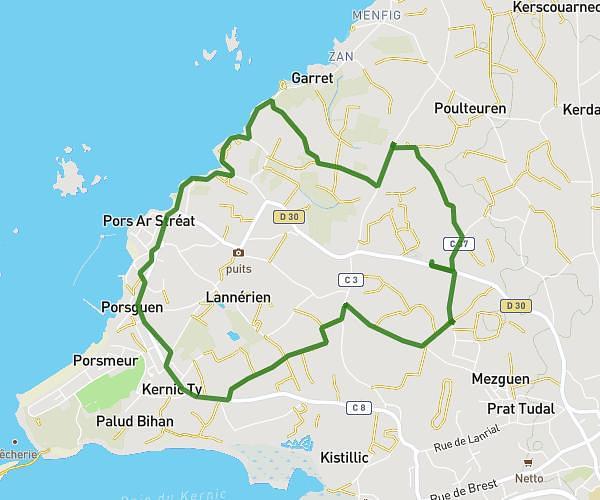
This running route covers 3.496mi starting from Cléder, Finistère. The run is a loop trail and returns to the trailhead. This run is rated as easy, expect about 34m to complete it. The route has an elevation gain of 138ft and an elevation loss of 177ft.
Coucou
Route details
6.17mph
Speed
389 kcal
Calories burned
Loop trail
Route type
33ft
Min altitude
210ft
Max altitude
Route profile
138ft
Elevation gain
177ft
Elevation loss
33ft
Min altitude
210ft
Max altitude
How to get there
Trailhead: D 35, 29233 Cléder
GPS coordinates of the trailhead: 48.66214, -4.13855 / 48°39'43'' N, 4°8'18'' W