MapPlanner
3.109mi
Distance
25m
Duration
8:02/mi
Pace
Easy
Level

Indre et Loire sur 5 km

Route details

7.46mph
Speed
286 kcal
Calories burned
Point to point
Route type
105ft
Min altitude
141ft
Max altitude

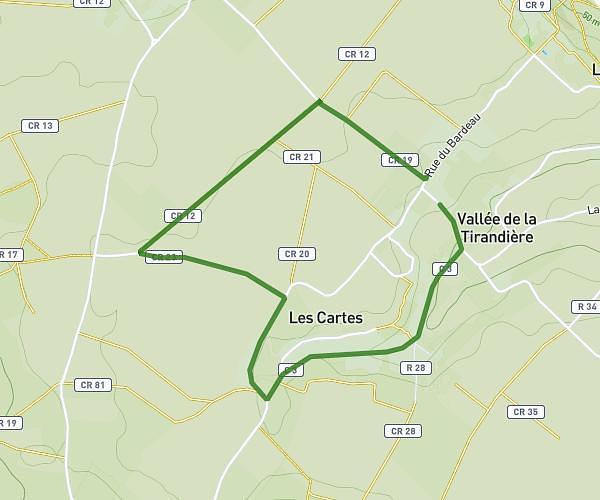
This running route covers 3.109mi starting from Huismes, Indre-et-Loire. The run does not return to the trailhead and ends near C 6, 37420 Huismes. This run is rated as easy, expect about 25m to complete it. The route has an elevation gain of 98ft and an elevation loss of 105ft.

Description of the route by the creator

Along the 2 watercourses on all types of paths

(Description automatically translated)

Route profile

98ft
Elevation gain
105ft
Elevation loss
105ft
Min altitude
141ft
Max altitude

How to get there

Trailhead: Chemin De La Mandiance, 37420 Huismes

GPS coordinates of the trailhead: 47.24143, 0.24939 / 47°14'29'' N, 0°14'57'' E

Caution: May Cross Private Property

This route may pass through or near private property. Always respect posted signs, obtain permission where required, and follow local trespassing laws. MapPlanner does not guarantee public access along any route.

Safety Notice

Trail and road conditions may change without notice due to weather, construction, or other factors. Always verify current conditions before heading out. You are responsible for your own safety — follow local signage, obey traffic laws, and use your best judgment on the trail.