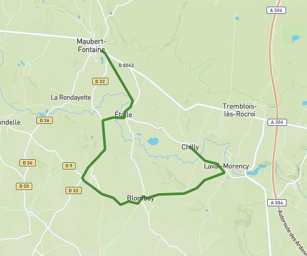
This running route covers 12.503mi starting from Chilly, Ardennes. The run does not return to the trailhead and ends near D 132, 08260 Chilly, France. This run is rated as strenuous, expect about 2h14m to complete it. The route has an elevation gain of 262ft and an elevation loss of 374ft.
Test 20k
Route details
5.6mph
Speed
1532 kcal
Calories burned
Point to point
Route type
666ft
Min altitude
1030ft
Max altitude
Route profile
262ft
Elevation gain
374ft
Elevation loss
666ft
Min altitude
1030ft
Max altitude
How to get there
Trailhead: 26 Grande Rue, 08260 Chilly, France
GPS coordinates of the trailhead: 49.838055, 4.473782 / 49°50'16'' N, 4°28'25'' E