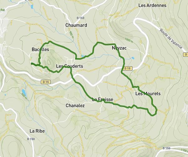
This walking route covers 6.853mi starting from Ouides, Haute-Loire. The walk is a loop trail and returns to the trailhead. This walk is rated as hard, plan for about 2h27m to complete it. The route has an elevation gain of 823ft and an elevation loss of 827ft.
Ouides /rossignol
Route details
21:27/mi
Pace
600 kcal
Calories burned
Loop trail
Route type
3596ft
Min altitude
4265ft
Max altitude
Route profile
823ft
Elevation gain
827ft
Elevation loss
3596ft
Min altitude
4265ft
Max altitude
How to get there
Trailhead: Impasse Des Epinettes, 43510 Ouides, France
GPS coordinates of the trailhead: 44.903813, 3.73751 / 44°54'13'' N, 3°44'15'' E