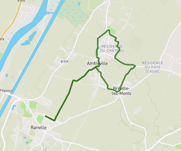
This walking route covers 3.025mi starting from Sannerville, Calvados. The walk is a loop trail and returns to the trailhead. This walk is rated as easy, plan for about 1h30m to complete it. The route has an elevation gain of 20ft and an elevation loss of 23ft.
5km Sannerville CCAS
Route details
29:43/mi
Pace
368 kcal
Calories burned
Loop trail
Route type
36ft
Min altitude
56ft
Max altitude
Route profile
20ft
Elevation gain
23ft
Elevation loss
36ft
Min altitude
56ft
Max altitude
How to get there
Trailhead: Espace François Mitterrand, 14940 Sannerville, France
GPS coordinates of the trailhead: 49.17953, -0.22479 / 49°10'46'' N, 0°13'29'' W