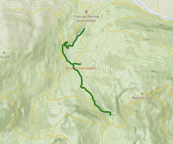
This hiking trail covers 4.819mi starting from Ossiach, Carinthia. The hike is a loop trail and returns to the trailhead. This hike is rated as strenuous, plan for about 2h35m to complete it. The route has an elevation gain of 1650ft and an elevation loss of 1650ft.
Ostriach
Route details
1.86mph
Speed
1202 kcal
Calories burned
13.0%
Avg grade
Loop trail
Route type
1686ft
Min altitude
3018ft
Max altitude
Steep climb
Route profile
1650ft
Elevation gain
1650ft
Elevation loss
1686ft
Min altitude
3018ft
Max altitude
How to get there
Trailhead: Ossiachersee-Südufer Straße 18, 9570 Ossiach, Austria
GPS coordinates of the trailhead: 46.66371, 13.97498 / 46°39'49'' N, 13°58'29'' E