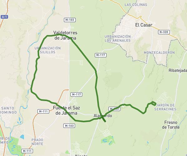
This cycling route covers 21.35mi starting from Valdeolmos-Alalpardo, Madrid. The ride is a loop trail and returns to the trailhead. This route is rated as moderate, plan for about 2h9m to complete it. The route has an elevation gain of 338ft and an elevation loss of 305ft.
35 km
Route details
1133 kcal
Calories burned
0.6%
Avg grade
Loop trail
Route type
2021ft
Min altitude
2326ft
Max altitude
Route profile
338ft
Elevation gain
305ft
Elevation loss
2021ft
Min altitude
2326ft
Max altitude
How to get there
Trailhead: Calle Alcalá 23d, 28130 Valdeolmos-Alalpardo, Madrid, Spain
GPS coordinates of the trailhead: 40.626658, -3.473207 / 40°37'35'' N, 3°28'23'' W