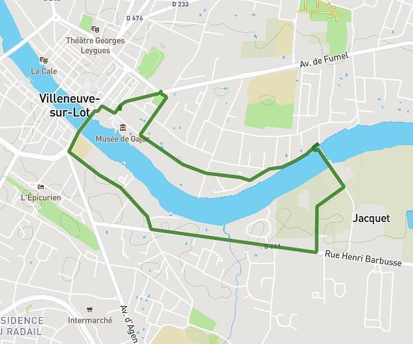
This running route covers 3.159mi starting from Agen, Lot-et-Garonne. The run is a loop trail and returns to the trailhead. This run is rated as easy, expect about 35m5s to complete it. The route has an elevation gain of 276ft and an elevation loss of 276ft.
5km
Route details
5.4mph
Speed
401 kcal
Calories burned
Loop trail
Route type
161ft
Min altitude
328ft
Max altitude
Route profile
276ft
Elevation gain
276ft
Elevation loss
161ft
Min altitude
328ft
Max altitude
How to get there
Trailhead: 56 Rue Jean-Louis Belloc, 47000 Agen, France
GPS coordinates of the trailhead: 44.20503, 0.63436 / 44°12'18'' N, 0°38'3'' E