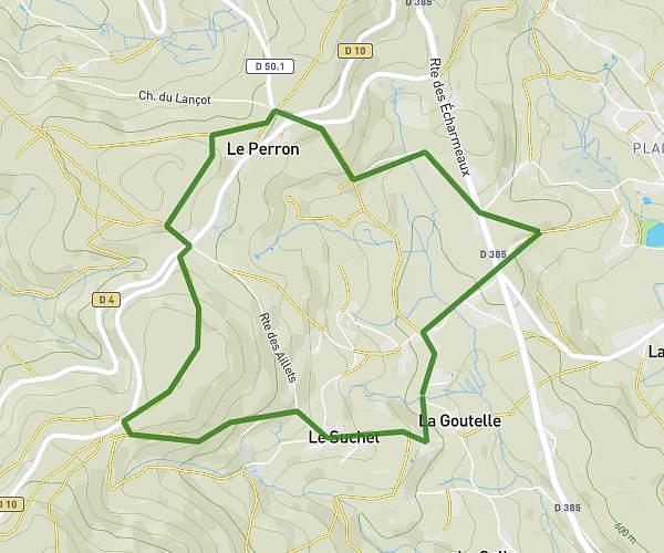
This running route covers 6.843mi starting from Rivolet, Rhône. The run is a loop trail and returns to the trailhead. This run is rated as moderate, expect about 1h13m to complete it. The route has an elevation gain of 1453ft and an elevation loss of 1450ft.
11km Rivolet
Route details
5.62mph
Speed
835 kcal
Calories burned
Loop trail
Route type
1109ft
Min altitude
2195ft
Max altitude
Route profile
1453ft
Elevation gain
1450ft
Elevation loss
1109ft
Min altitude
2195ft
Max altitude
How to get there
Trailhead: 473 Route De La Grange Du Loup, 69640 Rivolet, France
GPS coordinates of the trailhead: 46.005979, 4.583597 / 46°0'21'' N, 4°35'0'' E