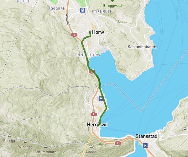
This running route covers 3.291mi starting from Hergiswil, Nidwalden. The run does not return to the trailhead and ends near 4, 6048 Horw, Switzerland. This run is rated as easy, expect about 30m53s to complete it. The route has an elevation gain of 574ft and an elevation loss of 633ft.
Tempolauf 30 Minuten
Route details
6.39mph
Speed
353 kcal
Calories burned
Point to point
Route type
1411ft
Min altitude
1663ft
Max altitude
Route profile
574ft
Elevation gain
633ft
Elevation loss
1411ft
Min altitude
1663ft
Max altitude
How to get there
Trailhead: Seestrasse, 6052 Hergiswil, Switzerland
GPS coordinates of the trailhead: 46.979894, 8.328925 / 46°58'47'' N, 8°19'44'' E