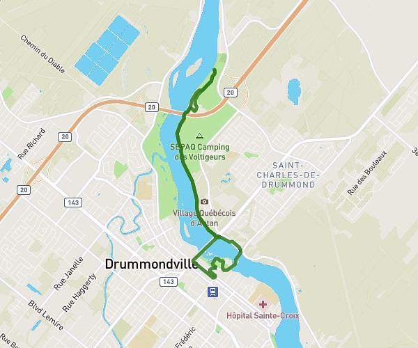
This running route covers 4.682mi starting from Drummondville, Quebec. The run is a loop trail and returns to the trailhead. This run is rated as easy, expect about 50m to complete it. The route has an elevation gain of 26ft and an elevation loss of 30ft.
industrielle
Route details
5.62mph
Speed
572 kcal
Calories burned
Loop trail
Route type
243ft
Min altitude
272ft
Max altitude
Route profile
26ft
Elevation gain
30ft
Elevation loss
243ft
Min altitude
272ft
Max altitude
How to get there
Trailhead: 2270 Place Montgrand, Drummondville, Quebec J2C 6M5, Canada
GPS coordinates of the trailhead: 45.867774, -72.52365 / 45°52'3'' N, 72°31'25'' W