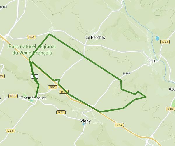
This running route covers 3.001mi starting from Épiais-Rhus, Val-d'Oise. The run is a loop trail and returns to the trailhead. This run is rated as easy, expect about 29m to complete it. The route has an elevation gain of 335ft and an elevation loss of 312ft.
Epiais-Rhus à Grisy les Platres
Route details
6.21mph
Speed
332 kcal
Calories burned
Loop trail
Route type
449ft
Min altitude
623ft
Max altitude
Route profile
335ft
Elevation gain
312ft
Elevation loss
449ft
Min altitude
623ft
Max altitude
How to get there
Trailhead: 4 Rue Saint-Didier, 95810 Épiais-Rhus, France
GPS coordinates of the trailhead: 49.1221, 2.06283 / 49°7'19'' N, 2°3'46'' E