MapPlanner
4.795mi
Distance
2h
Duration
25:01/mi
Pace
Easy
Level

Bugarach 1

Route details

2.4mph
Speed
1372 kcal
Calories burned
Loop trail
Route type
2001ft
Min altitude
3825ft
Max altitude

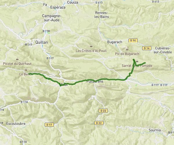
This running route covers 4.795mi starting from Bugarach, Aude. The run is a loop trail and returns to the trailhead. This run is rated as easy, expect about 2h to complete it. The route has an elevation gain of 2064ft and an elevation loss of 2021ft.

Route profile

2064ft
Elevation gain
2021ft
Elevation loss
2001ft
Min altitude
3825ft
Max altitude

How to get there

Trailhead: D 45, 11190 Bugarach, France

GPS coordinates of the trailhead: 42.85594, 2.36719 / 42°51'21'' N, 2°22'1'' E

Caution: May Cross Private Property

This route may pass through or near private property. Always respect posted signs, obtain permission where required, and follow local trespassing laws. MapPlanner does not guarantee public access along any route.

Safety Notice

Trail and road conditions may change without notice due to weather, construction, or other factors. Always verify current conditions before heading out. You are responsible for your own safety — follow local signage, obey traffic laws, and use your best judgment on the trail.